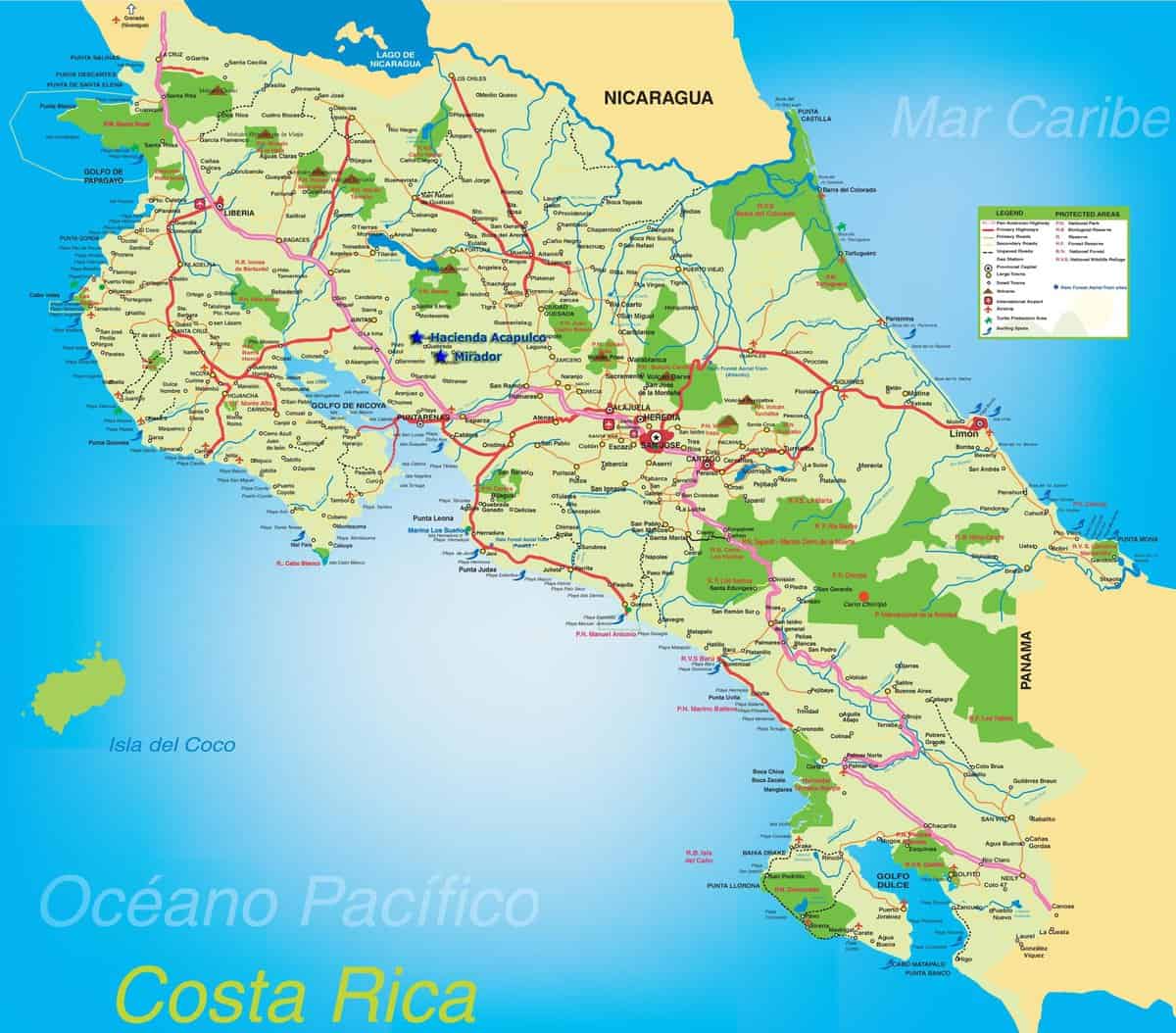
Planning Your Route in Costa Rica
Don’t be deceived by its small size; the mountainous terrain means the shortest distance between two points on a Costa Rica map is never a straight line. Earthquakes and torrential rainfall can mean many roads are in poor condition. A limited national budget means that road signs and lane markings leave tourists in the dark about where the road goes and how to get to their destination.
A Costa Rica map can be deceptively simple. For instance, Monteverde and Arenal are two popular tourist destinations in Costa Rica, though they are actually very close (about 20 miles) as the crow flies, it takes about four hours to drive from one to the other in a 4WD vehicle. Choosing your routes and where you will try to visit in a one or two-week vacation requires local knowledge of the road conditions and other transportation options.
Click Map to Enlarge

Top Tips for Planning Your Route Around Costa Rica
- – Speak to a Local Specialist. Having a Travel Company in Costa Rica will provide you with the very latest information you need to get around. From one day to the next, there can be road closures, adverse weather conditions, and delays due to roadworks/events/national holidays. If you get a flat tire on the highway in Costa Rica, will you travel agent in the US know who to call?
- – In you choose to self-drive in Costa Rica, download Waze to keep up to date with the best route to take.
- – Do not leave too late. Driving in the dark in Costa Rica is not recommended, so make sure you leave enough time to arrive before dark (and add some extra time for any potential delays).
- – Keep your itinerary realistic. The temptation to move from one place to the next every day or so can be tiring. Remember, even though the country looks small on the map, it takes time to travel from A to B. Our Travel Experts can help advise on where it makes sense to stay overnight, and which destinations deserve more time.
